By News Pulse Desk | May 3, 2026
Mapping the Geography of Anger
The extraordinarily high voter turnout in the 2026 West Bengal Assembly Election has left both major political camps—the Trinamool Congress (TMC) and the Bharatiya Janata Party (BJP)—processing contradicting signals. While direct welfare benefits like Lakshmir Bhandar were expected to secure the ruling party’s base, the staggering turnout in specific regions suggests a powerful, competing motivation. To truly understand this mandate, we must move beyond state-wide averages and begin Mapping the Geography of the anti-incumbency surge.
This localized approach is crucial because the defining feature of the 2026 campaign was not a single statewide issue, but a series of hyper-local, explosive events that occurred over the preceding two years. The most significant among these was the complex and violent social movement in Sandeshkhali. Mapping the Geography of voter anger means directly contrasting where these major protests and social movements occurred with the subsequent voting patterns.
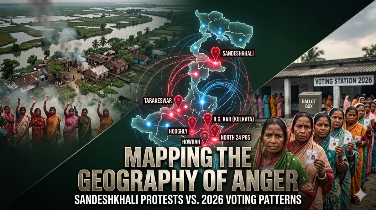
The Epicenter: Mapping the Geography of Sandeshkhali
The Sandeshkhali movement, which erupted in 2024 centered on allegations of land grabbing, sexual harassment, and institutional complicity, became a national focal point. When we begin Mapping the Geography of the political fallout, the constituencies within the Basirhat Lok Sabha region—including the Sandeshkhali assembly seat itself—show extraordinary anomalies.
In these seats, voter turnout wasn’t just high; it was unprecedented, mirroring the energy of the initial protests. Local observers suggest that the primary goal of Mapping the Geography of voter participation here reveals a “dignity-over-doles” sentiment. The deep social scabs left by the Sandeshkhali issue appear to have driven people to the ballot box in search of accountability, potentially overriding the typical pull of welfare schemes. This localized analysis is the only way to understand if the TMC’s perceived mishandling of the crisis catalyzed a fundamental shift.
Mapping the Geography of Urban Dissent: The R.G. Kar Factor
The methodology of Mapping the Geography of anti-incumbency must also incorporate urban dissent, particularly the profound, statewide movement ignited by the R.G. Kar tragedy in late 2024. While the tragedy resonated across Bengal, the sustained “Reclaim the Night” protests were focused on Kolkata and its neighboring industrial areas.
By Mapping the Geography of voter behavior in these urban strongholds, analysts are looking for subtle, yet devastating, shifts. Urban seats in Kolkata, North 24 Parganas, and Howrah, long considered an impenetrable Urban Bastion for the TMC, are expected to show the impact of this moral anger. If we see a dramatic reduction in TMC’s traditional victory margins in these sophisticated urban pockets, the process of Mapping the Geography of dissent will confirm that the R.G. Kar sentiment crossed class barriers to neutralize typical voting priorities. This analysis directly complements our earlier exploration of the Silent Voter Theory.
Beyond the Metropolis: Conflict Mapping in the Districts
The critical work of Mapping the Geography of political change is not limited to headline-grabbing events. It must also track smaller, but impactful, localized movements in the districts. Areas where intense opposition occurred over agricultural land acquisition, perceived corruption in the PMAY (Pradhan Mantri Awas Yojana) distribution, or localized environmental issues, are key targets for Mapping the Geography of discontent.
In Hooghly and dynamic semi-urban seats like Tarakeswar, Mapping the Geography of local grievance reveals whether the combined impact of nationalistic messaging and anti-corruption campaigns broke the TMC’s localized infrastructure. If these districts, traditionally TMC strongholds, show a synchronized shift towards the BJP, it would be the clearest sign yet of a coordinated, statewide anti-incumbency surge, validating the Exit Poll Paradox predictions of a significant BJP breakthrough.
Conclusion: A Data-Driven Destiny
The final mandate, scheduled for release on May 4, will validate which narrative dominated. However, the most profound sociopolitical shifts will only be visible by rigorously Mapping the Geography of the final numbers.
The results from protest hotspots, starting from Sandeshkhali, through urban Kolkata, into the agricultural belts of Hooghly, will serve as a permanent sociological record. By Mapping the Geography of these results, analysts will finally determine if 2026 Bengal prioritized the security of welfare benefits, as seen in official Lakshmir Bhandar data, or if localized social anger created an irreversible current of political change. The definitive answers lie in Mapping the Geography of the 294 seats of West Bengal.